The Canadian Urban Institute's “Pandemic Impact on Main Street” project highlights how civic infrastructure investment is essential to the resiliency of main streets. In the case of our area of focus, Kennedy Road, an absence of civic infrastructure and low social connectivity suggests that more can be done to build resiliency through equity-focused civic infrastructure investments designed to enhance community well-being among its users. The issues faced by communities within Scarborough have been historically overlooked by provincial governance, and this was only exacerbated by COVID-19.
We propose a nature-based solution (NbS) in conjunction with road infrastructure improvements to address Kennedy Road’s lack of community and vitality.
Background research
Our project focuses on the section of Kennedy Road covered by the Kennedy BIA, which stretches between Hwy 401 and St. Lawrence Ave. I contributed to a comprehensive literature review on the characteristics of the area, which included road safety statistics, census data and demographics, and land use.
Characteristics of the Kennedy Road BIA (infographic generated by me)
Interviews with a diverse set of stakeholders revealed a few crucial issues faced by community residents. Our design aims to address the main challenges facing stakeholders on Kennedy Road, which include issues of road permeability and safety, as well as insufficient civic infrastructure designed to promote community building.
Community research and data visualizations
As the team’s technical student, my role heavily involved processing data, e.g. Environics movement data, and creating data visualizations to effectively identify and communicate the issues faced by the community. To complement insights generated by user interviews, I parsed Environics 2022 Mobile Movement data and the government census data, and produced data visualizations to help communicate some of the issues faced by the community in Dorset Park. I leveraged the class Environics workshop to parse the necessary information.
After identifying the crucial issues faced by community members, we needed to create a framework with which to assess and structure our design solution around. We decided to restructure our design interventions around Toronto's Resilience Strategy in order to align our solution with a structured city-wide effort. I identified key actions from the Strategy to focus our design on. We referred to this in both the design process (as illustrated in the table) and in the assessment of our design.
Assessing the efficacies of different kinds of nature-based solutions (NbS)
Sankey diagram relating the components of our solution to the Toronto Resilience Strategy's goals and actions (created by me)
Design process
In conjunction with the policy-focused member of our team, my role was to do the research to support the designs produced by team members with urban design and architecture backgrounds. As a UX/UI designer, I wanted to help ensure our design leveraged existing research and urban design solutions to maximize its efficacy.
Component A: Improvements to Road Infrastructure, Permeability and Safety
Government data, stakeholder interviews, and onsite intersection observations, painted a comprehensive view of the road safety issue. Scarborough has the highest rate of collisions of the city’s four districts due to many of Scarborough’s roads, including Kennedy Road, being high speed arterial roads.
My main role in this portion of the design was supporting the choice of road improvements through a comprehensive literature review. I provided supplementary research based on a review of existing literature and government transit documents, such as collision rates at road intersections, and research conducted on the impacts of walkability. My findings led to a refocus on active transportation and road infrastructure improvements that directly addressed the unpleasant conditions faced by pedestrians and cyclists.
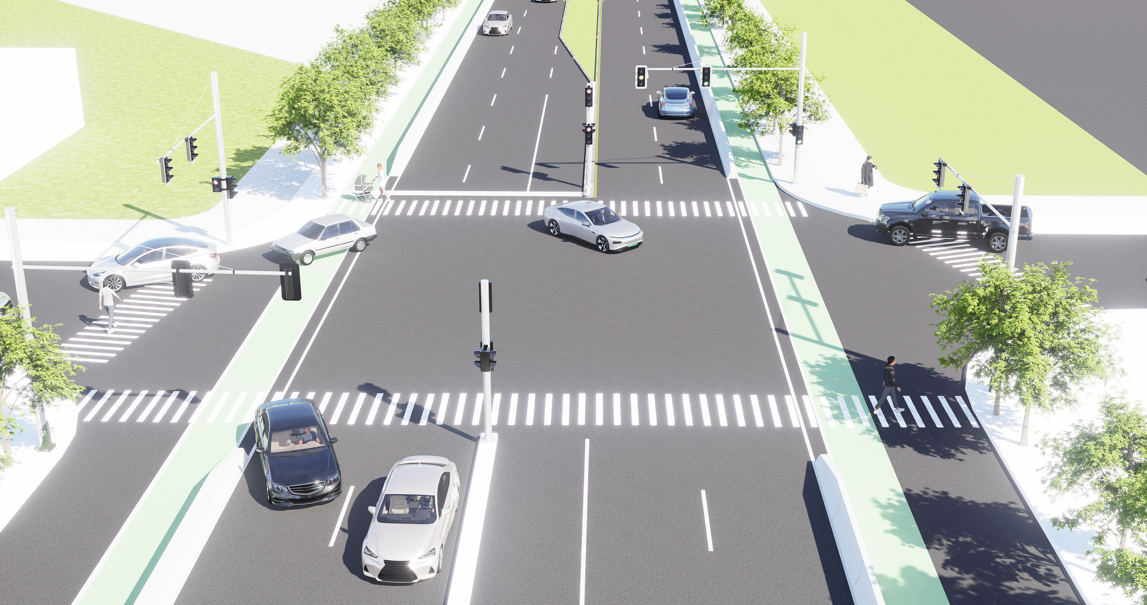
Intersection of Forbes & Kennedy with new road infrastructure: protected bike lanes, widened sidewalks, and tree planting.
Component B: Ellendale Park & Fostering Community
For this component of the design, we propose developing the wetland area near Kennedy and Ellendale Drive into a park, "Ellendale Park". To address the lack of community bonding on our street, Ellendale Park will serve multiple purposes, including as an interactive community garden and gathering space.
As a UX/UI designer, I wanted to ensure that our solution considered all angles of the issues faced by the community, especially given the diversity of the area and the history of whitewashing green spaces in North America. First, in order to fully understand the gaps within green infrastructure in the area, I investigated the existing implementation of green infrastructure in the area. Then, I did comprehensive research into a variety of topics, such as building equitable green spaces, inclusive community gardens, and wetland preservation. Kabisch argues that during times of land scarcity and competing land-use in urban areas, multipurpose, pluralistic land-use is key to building resilient cities. Therefore, ensuring Ellendale Park was designed in a multifaceted, multidimensional way was crucial.
Final rendering of Ellendale Park with influential NbS case studies (conducted by me)
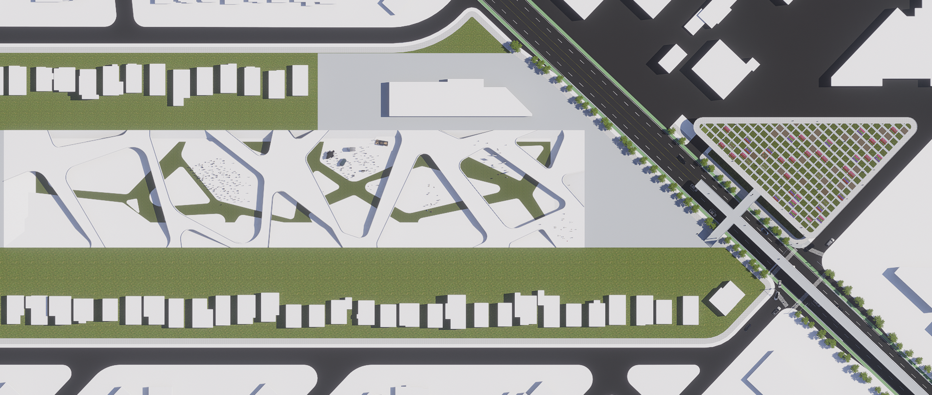
Final render of Ellendale Park
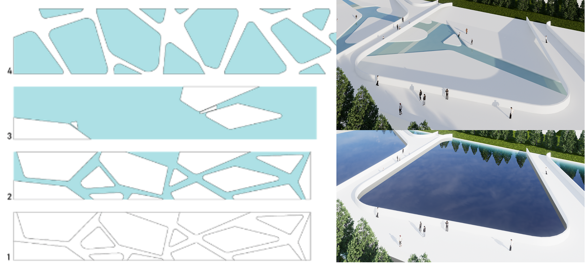
Flood resilience & layering
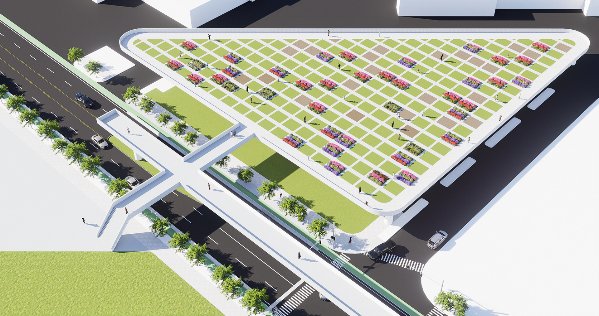
Community garden: Aerial View
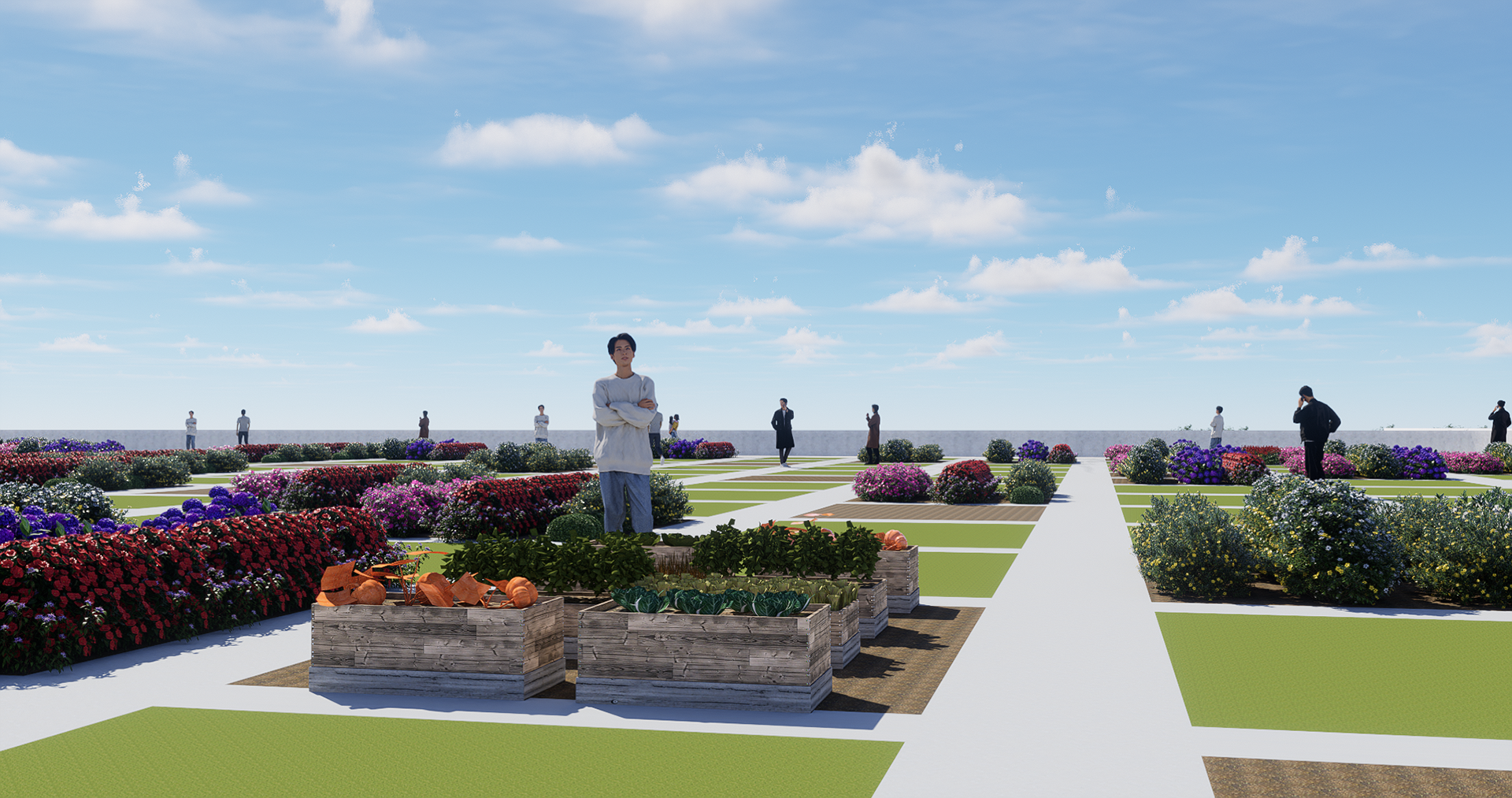
Community garden: Closeup rendering
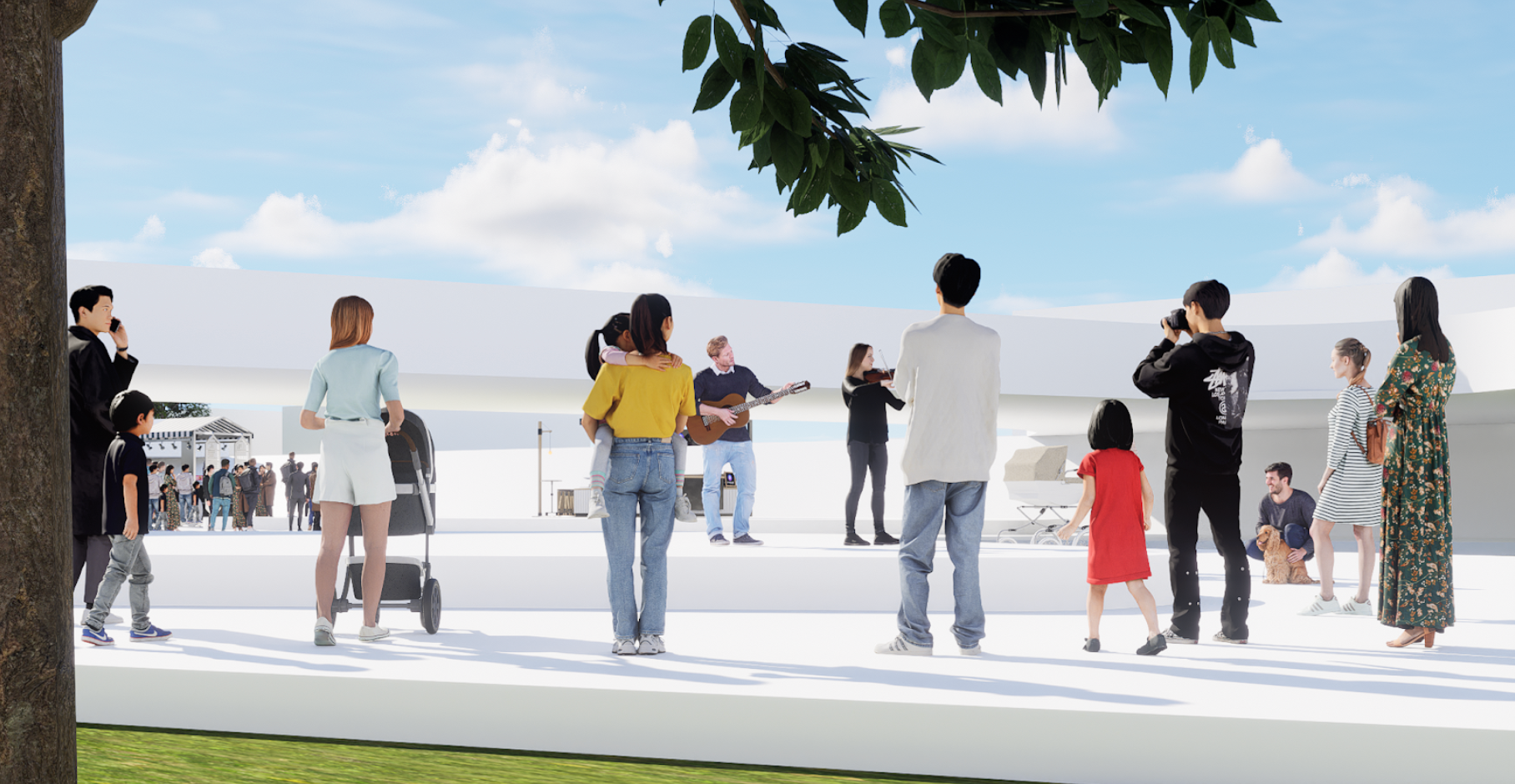
Community gathering space
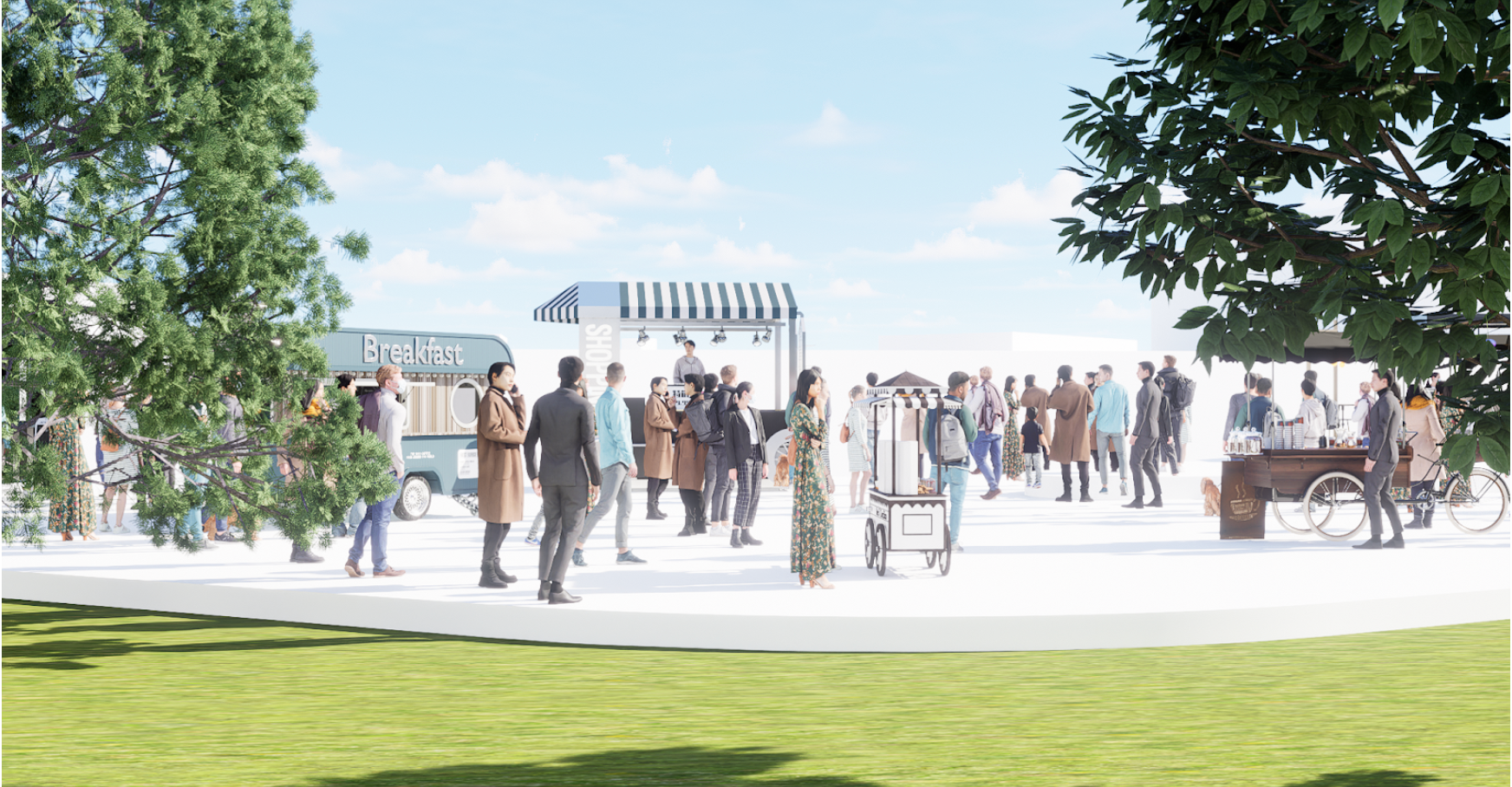
Community programming: local market
